
Open the newest Maryland storm on the live map: radar as it comes in, NWS reports as they are filed, and both radar surfaces for any past storm date.
Roofing leads / Maryland report
Maryland roofing leads. Find your next area.
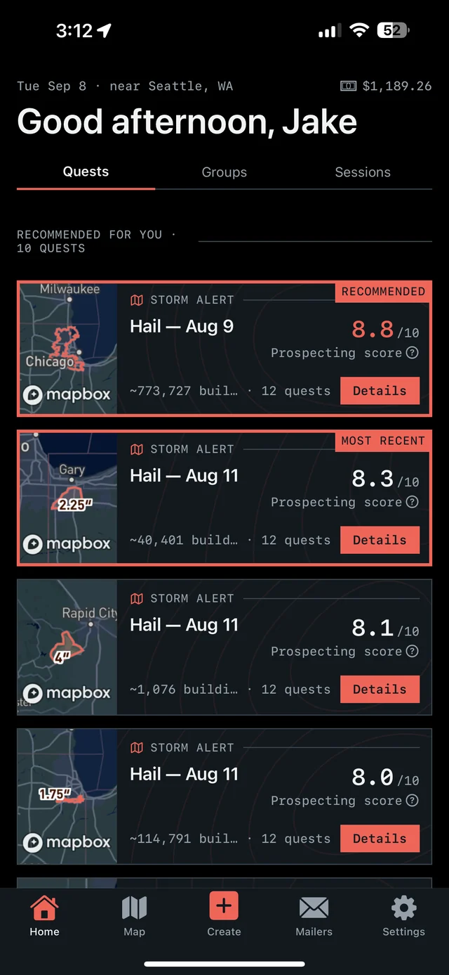
See where hail hit in Maryland, then take the next step on iPhone. Overview brings together hail maps, recommended places to prospect, and tools for the doors you work.

7-day free trial in the iPhone app. No card required to start.
For iPhone. Android coming soon.

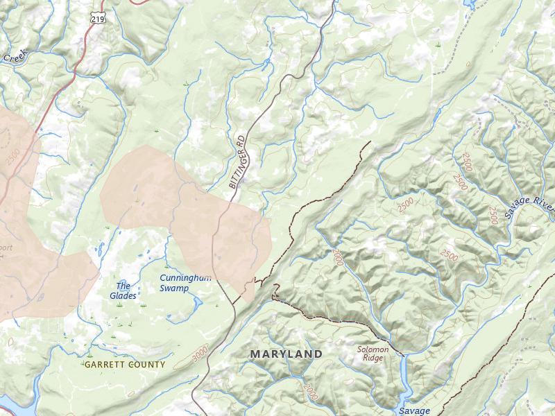
Radar-estimated size
Peak indicated size 0.5" Grantsville, MD
Overview for iPhone
Find your next move in Maryland.
Hail maps, recommended places to prospect, and canvassing in one app.
01
See the hail
See storm footprints and radar-estimated hail size over the streets you could work.
02
Pick your area
Open your recommendations, compare the areas, and choose your next place to prospect.
03
Go canvass
Get directions, start your session, and keep a record of the doors you work.
Our proprietary Prospecting Score brings promising areas into focus. In the app, Quests turn recommendations, follow-ups, and unfinished work into a clear next move.
7-day free trial in the iPhone app. No card required to start.
For iPhone. Android coming soon.
Tracked markets 172 MD locality reports
Homes under the map 430,087 Across current locality footprints
Peak indicated size 3.25" ≈ baseball
Storm record Jan 4 – Sep 3, 2026 Newest storm date 9 days ago
Maryland markets
Move from the state report to the streets.
Each city record carries its storm history, peak indicated size, and the count of homes under the map.
Baltimore City 2.75"
Curtis Bay
- Last storm date
- Jul 28, 2026
- Homes under the map
- 30,879
Anne Arundel 2.75"
Odenton
- Last storm date
- Jul 4, 2026
- Homes under the map
- 22,203
Anne Arundel 2.5"
Millersville
- Last storm date
- Jul 18, 2026
- Homes under the map
- 21,542
Baltimore 2.75"
Rosedale
- Last storm date
- Jul 28, 2026
- Homes under the map
- 18,539
Montgomery 2"
Gaithersburg
- Last storm date
- Jul 28, 2026
- Homes under the map
- 16,784
Anne Arundel 2.5"
Severna Park
- Last storm date
- Jul 18, 2026
- Homes under the map
- 16,691
Anne Arundel 2"
Hanover
- Last storm date
- Jul 18, 2026
- Homes under the map
- 16,293
Montgomery 1.75"
Rockville
- Last storm date
- Jul 28, 2026
- Homes under the map
- 15,869
Anne Arundel 2.25"
Pasadena
- Last storm date
- Jul 28, 2026
- Homes under the map
- 15,387
Anne Arundel 2.5"
Glen Burnie
- Last storm date
- Jul 28, 2026
- Homes under the map
- 14,890
Harford 1.75"
Bel Air
- Last storm date
- Jul 28, 2026
- Homes under the map
- 8,843
Baltimore 2.5"
Essex
- Last storm date
- Jul 28, 2026
- Homes under the map
- 7,662
Harford 0.75"
Fallston
- Last storm date
- Aug 10, 2026
- Homes under the map
- 6,957
Harford 1.5"
Gunpowder
- Last storm date
- Aug 10, 2026
- Homes under the map
- 6,322
Frederick 1.75"
Mount Airy
- Last storm date
- Sep 3, 2026
- Homes under the map
- 6,143
Baltimore 2.75"
Baltimore
- Last storm date
- Aug 7, 2026
- Homes under the map
- 5,211
Frederick 2"
New Market
- Last storm date
- Sep 3, 2026
- Homes under the map
- 5,132
Montgomery 1"
North Potomac
- Last storm date
- Jul 4, 2026
- Homes under the map
- 5,099
Harford 1.75"
Aberdeen
- Last storm date
- Jul 28, 2026
- Homes under the map
- 4,965
Anne Arundel 2.25"
Annapolis
- Last storm date
- Jul 28, 2026
- Homes under the map
- 4,732
Prince George's 2.5"
Upper Marlboro
- Last storm date
- Jul 21, 2026
- Homes under the map
- 4,642
Montgomery 2.5"
Silver Spring
- Last storm date
- Jul 28, 2026
- Homes under the map
- 4,382
Baltimore 1"
Phoenix
- Last storm date
- Aug 10, 2026
- Homes under the map
- 4,345
Frederick 3.25"
Woodsboro
- Last storm date
- Jul 4, 2026
- Homes under the map
- 4,310
Prince George's 1.25"
Capitol Heights
- Last storm date
- Jul 5, 2026
- Homes under the map
- 3,954
Frederick 2"
Adamstown
- Last storm date
- Aug 27, 2026
- Homes under the map
- 3,920
Prince George's 0.5"
Oxon Hill
- Last storm date
- Aug 10, 2026
- Homes under the map
- 3,920
Washington 1.75"
Hagerstown
- Last storm date
- Aug 10, 2026
- Homes under the map
- 3,777
Baltimore 1"
Baldwin
- Last storm date
- Aug 10, 2026
- Homes under the map
- 3,656
Howard 1"
Ellicott City
- Last storm date
- Jul 28, 2026
- Homes under the map
- 3,516
Washington 0.5"
Williamsport
- Last storm date
- Aug 27, 2026
- Homes under the map
- 3,444
Washington 1"
Keedysville
- Last storm date
- Aug 27, 2026
- Homes under the map
- 3,408
Montgomery 2.5"
Brinklow
- Last storm date
- Jul 28, 2026
- Homes under the map
- 3,361
Howard 2.5"
Clarksville
- Last storm date
- Jul 28, 2026
- Homes under the map
- 3,361
Baltimore 1"
Towson
- Last storm date
- Jul 4, 2026
- Homes under the map
- 3,334
Talbot 1.75"
Trappe
- Last storm date
- Jul 28, 2026
- Homes under the map
- 3,264
Howard 1.25"
Woodbine
- Last storm date
- Jul 28, 2026
- Homes under the map
- 3,118
Howard 2"
West Friendship
- Last storm date
- Jul 4, 2026
- Homes under the map
- 3,108
Montgomery 1.25"
Potomac
- Last storm date
- Jul 28, 2026
- Homes under the map
- 3,066
St. Mary's 2.25"
Lexington Park
- Last storm date
- Jul 22, 2026
- Homes under the map
- 2,985
Anne Arundel 2.5"
Lothian
- Last storm date
- Sep 3, 2026
- Homes under the map
- 2,871
Prince George's 1.75"
Fort Washington
- Last storm date
- Jul 21, 2026
- Homes under the map
- 2,869
Carroll 2"
Westminster
- Last storm date
- Jul 5, 2026
- Homes under the map
- 2,747
Frederick 3.25"
Frederick
- Last storm date
- Aug 10, 2026
- Homes under the map
- 2,688
Prince Georges 1.25"
College Park
- Last storm date
- Jul 5, 2026
- Homes under the map
- 2,650
Frederick 2.5"
Middletown
- Last storm date
- Jul 18, 2026
- Homes under the map
- 2,641
Dorchester 1.75"
East New Market
- Last storm date
- Jul 28, 2026
- Homes under the map
- 2,540
Charles 2"
Issue
- Last storm date
- Jul 4, 2026
- Homes under the map
- 2,533
Charles 2"
Newburg
- Last storm date
- Jul 4, 2026
- Homes under the map
- 2,533
Carroll 1.25"
Marriottsville
- Last storm date
- Jul 4, 2026
- Homes under the map
- 2,514
Calvert 1.25"
Port Republic
- Last storm date
- Jul 4, 2026
- Homes under the map
- 2,490
Carroll 1"
Taneytown
- Last storm date
- Jul 4, 2026
- Homes under the map
- 2,452
Baltimore 1.75"
Parkville
- Last storm date
- Aug 27, 2026
- Homes under the map
- 2,445
Carroll 2"
Finksburg
- Last storm date
- Jul 28, 2026
- Homes under the map
- 2,433
Harford 1.5"
Edgewood
- Last storm date
- Jul 28, 2026
- Homes under the map
- 2,424
Montgomery 1"
Boyds
- Last storm date
- Jul 28, 2026
- Homes under the map
- 2,345
Frederick 1.25"
Myersville
- Last storm date
- Jul 4, 2026
- Homes under the map
- 2,275
Montgomery 1.25"
Bethesda
- Last storm date
- Jul 28, 2026
- Homes under the map
- 2,268
Washington 1.5"
Sharpsburg
- Last storm date
- Jul 28, 2026
- Homes under the map
- 2,174
Montgomery 1.75"
Dickerson
- Last storm date
- Jul 28, 2026
- Homes under the map
- 2,041
Howard 1"
Columbia
- Last storm date
- Jul 28, 2026
- Homes under the map
- 2,027
Queen Annes 1"
Chester
- Last storm date
- Jul 26, 2026
- Homes under the map
- 1,955
Calvert 3"
Lusby
- Last storm date
- Jul 28, 2026
- Homes under the map
- 1,925
Prince George's 1.75"
Laurel
- Last storm date
- Jul 28, 2026
- Homes under the map
- 1,843
Calvert 1.75"
Saint Leonard
- Last storm date
- Jul 28, 2026
- Homes under the map
- 1,591
Dorchester 1.25"
Hurlock
- Last storm date
- Jul 6, 2026
- Homes under the map
- 1,566
Garrett 1.25"
Friendsville
- Last storm date
- Sep 3, 2026
- Homes under the map
- 1,560
Charles 0.75"
White Plains
- Last storm date
- Jun 14, 2026
- Homes under the map
- 1,515
Cecil 1"
Elkton
- Last storm date
- Sep 1, 2026
- Homes under the map
- 1,452
Saint Marys 1.25"
Clements
- Last storm date
- Jul 4, 2026
- Homes under the map
- 1,444
Calvert 2"
Prince Frederick
- Last storm date
- Jul 4, 2026
- Homes under the map
- 1,421
Frederick 1"
Union Bridge
- Last storm date
- Jul 28, 2026
- Homes under the map
- 1,328
Prince George's 2"
Brandywine
- Last storm date
- Jul 21, 2026
- Homes under the map
- 1,289
Caroline 1.75"
Henderson
- Last storm date
- Jul 18, 2026
- Homes under the map
- 1,284
Caroline 1.25"
Preston
- Last storm date
- Jul 28, 2026
- Homes under the map
- 1,272
Carroll 2"
Sykesville
- Last storm date
- Jul 28, 2026
- Homes under the map
- 1,224
Wicomico 0.75"
Hebron
- Last storm date
- Jul 6, 2026
- Homes under the map
- 1,221
Saint Marys 1.75"
Hollywood
- Last storm date
- Jul 28, 2026
- Homes under the map
- 1,212
Charles 1"
La Plata
- Last storm date
- Jul 9, 2026
- Homes under the map
- 1,207
Charles 1"
Port Tobacco
- Last storm date
- Jul 9, 2026
- Homes under the map
- 1,207
Caroline 1.25"
Ridgely
- Last storm date
- Jul 18, 2026
- Homes under the map
- 1,178
Washington 1"
Boonsboro
- Last storm date
- Jul 28, 2026
- Homes under the map
- 1,100
St. Mary's 1.75"
Leonardtown
- Last storm date
- Jul 22, 2026
- Homes under the map
- 1,073
Queen Anne's 2.5"
Centreville
- Last storm date
- Jul 18, 2026
- Homes under the map
- 1,062
Talbot 1.75"
Oxford
- Last storm date
- Jul 28, 2026
- Homes under the map
- 1,022
Allegany 1"
Cumberland
- Last storm date
- Jul 5, 2026
- Homes under the map
- 973
Prince George's 1"
Bowie
- Last storm date
- Jul 5, 2026
- Homes under the map
- 965
Prince Georges 1"
Glenn Dale
- Last storm date
- Jul 5, 2026
- Homes under the map
- 965
Queen Anne's 2.25"
Queenstown
- Last storm date
- Jul 28, 2026
- Homes under the map
- 889
Anne Arundel 1.75"
Davidsonville
- Last storm date
- Jul 21, 2026
- Homes under the map
- 828
Talbot 1"
Easton
- Last storm date
- Jul 28, 2026
- Homes under the map
- 822
Caroline 0.75"
Denton
- Last storm date
- Aug 20, 2026
- Homes under the map
- 797
Carroll 0.75"
New Windsor
- Last storm date
- Jul 28, 2026
- Homes under the map
- 763
Prince George's 0.75"
Aquasco
- Last storm date
- Aug 10, 2026
- Homes under the map
- 639
Frederick 1.25"
Clarksburg
- Last storm date
- Jul 5, 2026
- Homes under the map
- 638
Frederick 1"
Thurmont
- Last storm date
- Aug 10, 2026
- Homes under the map
- 615
Talbot 1"
Tilghman
- Last storm date
- Jul 18, 2026
- Homes under the map
- 606
St. Mary's 1.5"
Patuxent River
- Last storm date
- Jul 22, 2026
- Homes under the map
- 597
Kent 0.5"
Kennedyville
- Last storm date
- Aug 10, 2026
- Homes under the map
- 531
Anne Arundel 2.5"
Gibson Island
- Last storm date
- Jul 5, 2026
- Homes under the map
- 496
Washington 0.75"
Big Pool
- Last storm date
- Jun 14, 2026
- Homes under the map
- 479
Montgomery 1"
Damascus
- Last storm date
- Jul 5, 2026
- Homes under the map
- 461
Kent 2.5"
Rock Hall
- Last storm date
- Jul 26, 2026
- Homes under the map
- 451
Cecil 1"
North East
- Last storm date
- Jul 18, 2026
- Homes under the map
- 432
Caroline 1.25"
Greensboro
- Last storm date
- Jul 21, 2026
- Homes under the map
- 409
Wicomico 0.5"
Salisbury
- Last storm date
- Aug 28, 2026
- Homes under the map
- 398
Garrett 0.75"
Kitzmiller
- Last storm date
- Sep 3, 2026
- Homes under the map
- 369
Harford 0.5"
White Hall
- Last storm date
- Aug 10, 2026
- Homes under the map
- 363
Dorchester 3"
Taylors Island
- Last storm date
- Jul 28, 2026
- Homes under the map
- 362
Dorchester 1.75"
Cambridge
- Last storm date
- Aug 10, 2026
- Homes under the map
- 359
Allegany 1"
Corriganville
- Last storm date
- Apr 1, 2026
- Homes under the map
- 327
Wicomico 1"
Eden
- Last storm date
- Jul 6, 2026
- Homes under the map
- 314
Talbot 2.25"
Wye Mills
- Last storm date
- Sep 3, 2026
- Homes under the map
- 301
Talbot 1"
Cordova
- Last storm date
- Aug 20, 2026
- Homes under the map
- 292
Prince George's 1.25"
Greenbelt
- Last storm date
- Aug 7, 2026
- Homes under the map
- 281
Queen Anne's 2"
Church Hill
- Last storm date
- Jul 5, 2026
- Homes under the map
- 248
Talbot 1.75"
Royal Oak
- Last storm date
- Jul 28, 2026
- Homes under the map
- 245
Washington 1"
Clear Spring
- Last storm date
- May 20, 2026
- Homes under the map
- 241
Wicomico 1.25"
Bivalve
- Last storm date
- Aug 31, 2026
- Homes under the map
- 229
Garrett 1"
Frostburg
- Last storm date
- Aug 10, 2026
- Homes under the map
- 224
Garrett 1"
Grantsville
- Last storm date
- Sep 3, 2026
- Homes under the map
- 224
Saint Marys 2.25"
Dameron
- Last storm date
- Jul 6, 2026
- Homes under the map
- 222
Saint Marys 2.25"
Ridge
- Last storm date
- Jul 6, 2026
- Homes under the map
- 222
Queen Annes 1.25"
Queen Anne
- Last storm date
- Jul 18, 2026
- Homes under the map
- 219
Charles 1.25"
Indian Head
- Last storm date
- Jul 9, 2026
- Homes under the map
- 215
Somerset 1"
Crisfield
- Last storm date
- Jul 21, 2026
- Homes under the map
- 200
Charles 1.75"
Welcome
- Last storm date
- Jul 9, 2026
- Homes under the map
- 195
Somerset 0.5"
Westover
- Last storm date
- Jul 27, 2026
- Homes under the map
- 191
Baltimore 1.75"
White Marsh
- Last storm date
- Aug 7, 2026
- Homes under the map
- 178
Dorchester 1"
Rhodesdale
- Last storm date
- Jul 28, 2026
- Homes under the map
- 174
Anne Arundel 0.75"
Edgewater
- Last storm date
- Jul 9, 2026
- Homes under the map
- 152
Allegany 1"
Barton
- Last storm date
- Jul 5, 2026
- Homes under the map
- 139
Queen Anne's 1"
Stevensville
- Last storm date
- Aug 10, 2026
- Homes under the map
- 139
Allegany 1"
Westernport
- Last storm date
- Jul 5, 2026
- Homes under the map
- 139
Talbot 1.25"
Wittman
- Last storm date
- Jul 28, 2026
- Homes under the map
- 136
Charles 1.25"
Charlotte Hall
- Last storm date
- Jul 9, 2026
- Homes under the map
- 132
Kent 1.75"
Chestertown
- Last storm date
- Aug 20, 2026
- Homes under the map
- 125
Worcester 1.25"
Berlin
- Last storm date
- Jul 6, 2026
- Homes under the map
- 121
Charles 2"
Nanjemoy
- Last storm date
- Jul 9, 2026
- Homes under the map
- 103
Dorchester 1.75"
Woolford
- Last storm date
- Jul 28, 2026
- Homes under the map
- 96
Dorchester 1.25"
Church Creek
- Last storm date
- Jul 9, 2026
- Homes under the map
- 95
Garrett 0.5"
Oakland
- Last storm date
- Aug 10, 2026
- Homes under the map
- 92
Washington 1"
Hancock
- Last storm date
- May 18, 2026
- Homes under the map
- 88
Baltimore 0.5"
Cockeysville
- Last storm date
- Jun 14, 2026
- Homes under the map
- 73
Cecil 0.5"
Rising Sun
- Last storm date
- Jul 4, 2026
- Homes under the map
- 70
Montgomery 0.5"
Poolesville
- Last storm date
- Jul 11, 2026
- Homes under the map
- 67
Montgomery 1"
Germantown
- Last storm date
- Aug 7, 2026
- Homes under the map
- 63
Allegany 0.5"
Little Orleans
- Last storm date
- May 18, 2026
- Homes under the map
- 63
Frederick 1.75"
Keymar
- Last storm date
- Jul 18, 2026
- Homes under the map
- 55
St. Mary's 1.75"
Bushwood
- Last storm date
- Apr 1, 2026
- Homes under the map
- 53
St. Mary's 1.75"
Mechanicsville
- Last storm date
- Aug 10, 2026
- Homes under the map
- 50
Baltimore 1"
Middle River
- Last storm date
- Jul 5, 2026
- Homes under the map
- 38
Baltimore 0.5"
Upperco
- Last storm date
- May 20, 2026
- Homes under the map
- 36
Kent 1"
Worton
- Last storm date
- Jul 21, 2026
- Homes under the map
- 24
Queen Anne's 1.75"
Sudlersville
- Last storm date
- Aug 20, 2026
- Homes under the map
- 18
Frederick 1.75"
Jefferson
- Last storm date
- Sep 3, 2026
- Homes under the map
- 16
Wicomico 0.5"
Mardela Springs
- Last storm date
- Sep 3, 2026
- Homes under the map
- 15
Allegany 1"
Flintstone
- Last storm date
- Aug 22, 2026
- Homes under the map
- 10
Charles 1.5"
Waldorf
- Last storm date
- Sep 3, 2026
- Homes under the map
- 4
Somerset 1"
Ewell
- Last storm date
- Jul 21, 2026
- Homes under the map
- 1
Caroline 1"
Federalsburg
- Last storm date
- Apr 1, 2026
- Homes under the map
- 0
Somerset 0.75"
Marion Station
- Last storm date
- Jul 21, 2026
- Homes under the map
- 0
Calvert 1"
North Beach
- Last storm date
- Jul 28, 2026
- Homes under the map
- 0
Worcester 0.75"
Ocean City
- Last storm date
- Jul 21, 2026
- Homes under the map
- 0
Baltimore 0"
Owings Mills
- Last storm date
- Jul 4, 2026
- Homes under the map
- 0
Baltimore 0"
Pikesville
- Last storm date
- Jul 4, 2026
- Homes under the map
- 0
Worcester 0"
Pocomoke City
- Last storm date
- Jul 9, 2026
- Homes under the map
- 0
Cecil 0"
Port Deposit
- Last storm date
- Jul 5, 2026
- Homes under the map
- 0
Somerset 0"
Princess Anne
- Last storm date
- Apr 1, 2026
- Homes under the map
- 0
Wicomico 1"
Quantico
- Last storm date
- Jul 9, 2026
- Homes under the map
- 0
Wicomico 1"
Tyaskin
- Last storm date
- Jul 9, 2026
- Homes under the map
- 0
Dorchester 1"
Vienna
- Last storm date
- Jul 21, 2026
- Homes under the map
- 0
Reading the radar · Severe hail signal
What 3.25" radar-indicated hail means for field priority.
Two-inch-plus hail is capable of puncturing shingles, breaking skylights or windows, and heavily denting soft materials. The strongest radar bands warrant prompt inspection, but neither the signal nor the footprint confirms damage at a specific address.
State response workflow
Three steps from radar to a door.
The map in the app is live. These pages rebuild nightly.
Review recommended areas in the iPhone app, or draw the streets you want to work. Use the hail and neighborhood context to make your choice.
Get directions, start a canvassing session, and record your door outcomes, notes, and next steps. Return to no-answer doors and unfinished coverage later.
Overview Pro · iPhone + web
Take Maryland into the field.
The hail map, your next recommended area, and the tools to work it. Start on your own; the same subscription also includes access for up to 4 team members.
- Hail maps, storm history, and live radar
- Recommended prospecting areas and Quests
- Canvassing, navigation, and visit tracking
- Door notes, photos, and follow-up history
- Territory alerts and personal progress
Monthly subscription · US App Store
$149.99/ month
Try the app for 7 days. Choose whether to subscribe when your trial ends.
7-day free trial in the iPhone app. No card required to start.
For iPhone. Android coming soon.
200 addresses during the trial; 5,000 new addresses per user each month on Pro. Homeowner contacts ($0.21 each) and postcards ($0.75 each) are optional additional purchases.
Paid subscriptions renew monthly. Manage or cancel your App Store subscription in your Apple Account settings.
See all pricing and trial details →Take your next area into the field.
See the hail, review your recommendations, and canvass with Overview on iPhone.
7-day free trial in the iPhone app. No card required to start.
For iPhone. Android coming soon.
Radar tells you where to look. Only an inspection confirms damage at an address. Hail data is aggregated from public storm reporting and radar products; estimates are approximate. Contact availability varies by address.