
Open the newest Vermont storm on the live map: radar as it comes in, NWS reports as they are filed, and both radar surfaces for any past storm date.
Roofing leads / Vermont report
Vermont roofing leads. Find your next area.
See where hail hit in Vermont, then take the next step on iPhone. Overview brings together hail maps, recommended places to prospect, and tools for the doors you work.

7-day free trial in the iPhone app. No card required to start.
For iPhone. Android coming soon.

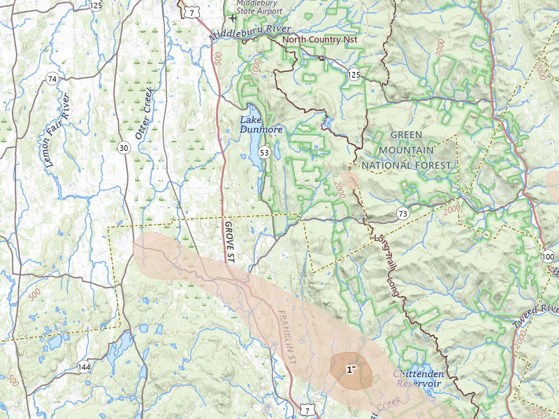
Radar-estimated size
Peak indicated size 1" Brandon, VT
Overview for iPhone
Find your next move in Vermont.
Hail maps, recommended places to prospect, and canvassing in one app.
01
See the hail
See storm footprints and radar-estimated hail size over the streets you could work.
02
Pick your area
Open your recommendations, compare the areas, and choose your next place to prospect.
03
Go canvass
Get directions, start your session, and keep a record of the doors you work.
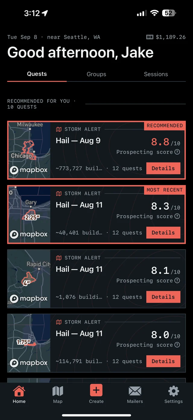
Our proprietary Prospecting Score brings promising areas into focus. In the app, Quests turn recommendations, follow-ups, and unfinished work into a clear next move.
7-day free trial in the iPhone app. No card required to start.
For iPhone. Android coming soon.
Tracked markets 65 VT locality reports
Homes under the map 29,516 Across current locality footprints
Peak indicated size 2.5" ≈ baseball
Storm record Apr 1 – Aug 12, 2026 Newest storm date 31 days ago
Vermont markets
Move from the state report to the streets.
Each city record carries its storm history, peak indicated size, and the count of homes under the map.
Chittenden 1.75"
Essex Junction
- Last storm date
- Jul 1, 2026
- Homes under the map
- 2,744
Rutland 0.75"
West Rutland
- Last storm date
- Jul 14, 2026
- Homes under the map
- 2,394
Chittenden 1.75"
Jericho
- Last storm date
- Jul 1, 2026
- Homes under the map
- 2,199
Windsor 0.75"
Norwich
- Last storm date
- Jul 1, 2026
- Homes under the map
- 1,724
Addison 1.75"
Brandon
- Last storm date
- Aug 12, 2026
- Homes under the map
- 1,703
Orange 2.5"
Williamstown
- Last storm date
- Apr 16, 2026
- Homes under the map
- 1,587
Franklin 0.5"
Saint Albans
- Last storm date
- Aug 10, 2026
- Homes under the map
- 1,367
Essex 0.5"
Guildhall
- Last storm date
- Jul 9, 2026
- Homes under the map
- 1,261
Addison 1"
Shoreham
- Last storm date
- Jul 14, 2026
- Homes under the map
- 1,056
Rutland 1.25"
Pittsford
- Last storm date
- Aug 12, 2026
- Homes under the map
- 1,005
Rutland 1.25"
Sudbury
- Last storm date
- Jul 14, 2026
- Homes under the map
- 986
Chittenden 1.5"
Underhill
- Last storm date
- Jul 1, 2026
- Homes under the map
- 857
Windsor 1"
Plymouth
- Last storm date
- Jul 14, 2026
- Homes under the map
- 806
Orange 1.75"
Newbury
- Last storm date
- Apr 16, 2026
- Homes under the map
- 778
Windsor 0.75"
Perkinsville
- Last storm date
- Jul 14, 2026
- Homes under the map
- 700
Orange 2.5"
Washington
- Last storm date
- Apr 16, 2026
- Homes under the map
- 679
Orange 1.75"
Topsham
- Last storm date
- Apr 16, 2026
- Homes under the map
- 558
Grand Isle 1"
South Hero
- Last storm date
- Jul 1, 2026
- Homes under the map
- 525
Orange 2.5"
West Topsham
- Last storm date
- Apr 16, 2026
- Homes under the map
- 509
Washington 2.5"
Roxbury
- Last storm date
- Apr 16, 2026
- Homes under the map
- 447
Rutland 0.75"
Castleton
- Last storm date
- Jul 14, 2026
- Homes under the map
- 443
Windsor 1"
Reading
- Last storm date
- Jul 14, 2026
- Homes under the map
- 438
Addison 2"
Orwell
- Last storm date
- Jun 6, 2026
- Homes under the map
- 412
Bennington 1"
Pownal
- Last storm date
- Jul 1, 2026
- Homes under the map
- 395
Rutland 1"
Rutland
- Last storm date
- Aug 12, 2026
- Homes under the map
- 376
Rutland 0.75"
Pawlet
- Last storm date
- Jul 1, 2026
- Homes under the map
- 374
Rutland 1"
Cuttingsville
- Last storm date
- Jul 14, 2026
- Homes under the map
- 329
Franklin 0.5"
Fairfield
- Last storm date
- Aug 10, 2026
- Homes under the map
- 276
Chittenden 1.75"
Milton
- Last storm date
- Jul 1, 2026
- Homes under the map
- 272
Rutland 0.75"
Killington
- Last storm date
- Jul 14, 2026
- Homes under the map
- 212
Bennington 1"
Rupert
- Last storm date
- Aug 12, 2026
- Homes under the map
- 197
Addison 1"
Ferrisburgh
- Last storm date
- Jul 1, 2026
- Homes under the map
- 175
Addison 0.5"
Cornwall
- Last storm date
- Jul 1, 2026
- Homes under the map
- 153
Addison 1"
Middlebury
- Last storm date
- Jul 1, 2026
- Homes under the map
- 153
Franklin 0.5"
Jeffersonville
- Last storm date
- Jun 12, 2026
- Homes under the map
- 142
Bennington 1"
Dorset
- Last storm date
- Jul 1, 2026
- Homes under the map
- 140
Lamoille 1.5"
Stowe
- Last storm date
- Jul 1, 2026
- Homes under the map
- 137
Windsor 0.5"
Stockbridge
- Last storm date
- Aug 12, 2026
- Homes under the map
- 135
Chittenden 1.75"
Westford
- Last storm date
- Jul 1, 2026
- Homes under the map
- 135
Rutland 0.75"
Bomoseen
- Last storm date
- Jul 14, 2026
- Homes under the map
- 102
Rutland 1.75"
Fair Haven
- Last storm date
- Jul 14, 2026
- Homes under the map
- 102
Washington 0.75"
Waitsfield
- Last storm date
- Jul 1, 2026
- Homes under the map
- 91
Windsor 1"
White River Junction
- Last storm date
- Jul 1, 2026
- Homes under the map
- 81
Chittenden 1.75"
Richmond
- Last storm date
- Jul 1, 2026
- Homes under the map
- 76
Caledonia 0.5"
Saint Johnsbury
- Last storm date
- Apr 1, 2026
- Homes under the map
- 76
Grand Isle 0.5"
North Hero
- Last storm date
- Aug 10, 2026
- Homes under the map
- 65
Addison 1"
New Haven
- Last storm date
- Jul 1, 2026
- Homes under the map
- 46
Orange 0.5"
Chelsea
- Last storm date
- Jul 1, 2026
- Homes under the map
- 38
Rutland 1.75"
Florence
- Last storm date
- Jul 1, 2026
- Homes under the map
- 30
Orange 0.5"
Corinth
- Last storm date
- Jul 1, 2026
- Homes under the map
- 24
Grand Isle 0.5"
Alburgh
- Last storm date
- Aug 10, 2026
- Homes under the map
- 2
Windsor 0.5"
North Pomfret
- Last storm date
- Jul 1, 2026
- Homes under the map
- 2
Windsor 1"
Woodstock
- Last storm date
- Jul 1, 2026
- Homes under the map
- 2
Windsor 0"
Bethel
- Last storm date
- Jul 1, 2026
- Homes under the map
- 0
Addison 1"
Bridport
- Last storm date
- Jul 1, 2026
- Homes under the map
- 0
Chittenden 1"
Charlotte
- Last storm date
- Jul 1, 2026
- Homes under the map
- 0
Rutland 1.25"
Chittenden
- Last storm date
- Jul 1, 2026
- Homes under the map
- 0
Caledonia 0"
East Hardwick
- Last storm date
- Jul 1, 2026
- Homes under the map
- 0
Addison 0.75"
Hancock
- Last storm date
- Jul 1, 2026
- Homes under the map
- 0
Rutland 1"
Middletown Springs
- Last storm date
- Jul 1, 2026
- Homes under the map
- 0
Rutland 0"
North Chittenden
- Last storm date
- Jul 1, 2026
- Homes under the map
- 0
Chittenden 1"
Shelburne
- Last storm date
- Jul 1, 2026
- Homes under the map
- 0
Addison 0"
Vergennes
- Last storm date
- Jul 1, 2026
- Homes under the map
- 0
Washington 1.75"
Warren
- Last storm date
- Jul 1, 2026
- Homes under the map
- 0
Addison 1"
Whiting
- Last storm date
- Jul 1, 2026
- Homes under the map
- 0
Reading the radar · Severe hail signal
What 2.5" radar-indicated hail means for field priority.
Two-inch-plus hail is capable of puncturing shingles, breaking skylights or windows, and heavily denting soft materials. The strongest radar bands warrant prompt inspection, but neither the signal nor the footprint confirms damage at a specific address.
State response workflow
Three steps from radar to a door.
The map in the app is live. These pages rebuild nightly.
Review recommended areas in the iPhone app, or draw the streets you want to work. Use the hail and neighborhood context to make your choice.
Get directions, start a canvassing session, and record your door outcomes, notes, and next steps. Return to no-answer doors and unfinished coverage later.
Overview Pro · iPhone + web
Take Vermont into the field.
The hail map, your next recommended area, and the tools to work it. Start on your own; the same subscription also includes access for up to 4 team members.
- Hail maps, storm history, and live radar
- Recommended prospecting areas and Quests
- Canvassing, navigation, and visit tracking
- Door notes, photos, and follow-up history
- Territory alerts and personal progress
Monthly subscription · US App Store
$149.99/ month
Try the app for 7 days. Choose whether to subscribe when your trial ends.
7-day free trial in the iPhone app. No card required to start.
For iPhone. Android coming soon.
200 addresses during the trial; 5,000 new addresses per user each month on Pro. Homeowner contacts ($0.21 each) and postcards ($0.75 each) are optional additional purchases.
Paid subscriptions renew monthly. Manage or cancel your App Store subscription in your Apple Account settings.
See all pricing and trial details →Take your next area into the field.
See the hail, review your recommendations, and canvass with Overview on iPhone.
7-day free trial in the iPhone app. No card required to start.
For iPhone. Android coming soon.
Radar tells you where to look. Only an inspection confirms damage at an address. Hail data is aggregated from public storm reporting and radar products; estimates are approximate. Contact availability varies by address.