Hail in Linn Creek · Jul 10, 2026
NEXRAD logged 0 hail signatures up to 1"; the estimated-size surface reached 0.5" aloft. Open it on the live map to see the swath over the streets.

7-day free trial in the iPhone app. No card required to start.
For iPhone. Android coming soon.

Web trial: 7 days free. Card required. $150/month after the trial unless cancelled.
Convective day · Jul 10, 2026 · noon–noon UTC
Severity
Linn Creek's only recorded storm in the last 12 months
Overview's storm severity score weighs hailstone size, homes in the footprint, and ground-truth reports.
- Peak hail signal
- 25 /100
- Homes exposed
- 46 /100
- Ground truth
- 0 /100
Largest radar-indicated size — a signal of damage potential, not confirmation.
How many homes sit inside the storm's footprint.
Independent storm reports filed with the NWS.
Evidence / storm surfaces
How Linn Creek saw the hail — from two instruments
Each storm gets two readings: the radar signatures NEXRAD recorded as the cells passed overhead, and a modeled estimate of hail size in the air. They are independent surfaces, so a mismatch between them is expected — and worth reading.
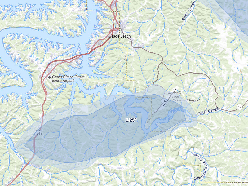 Radar signature field
 The point detections NEXRAD recorded overhead. Each signature marks where the radar saw hail aloft — it is a detection, not a stone measured on the ground.
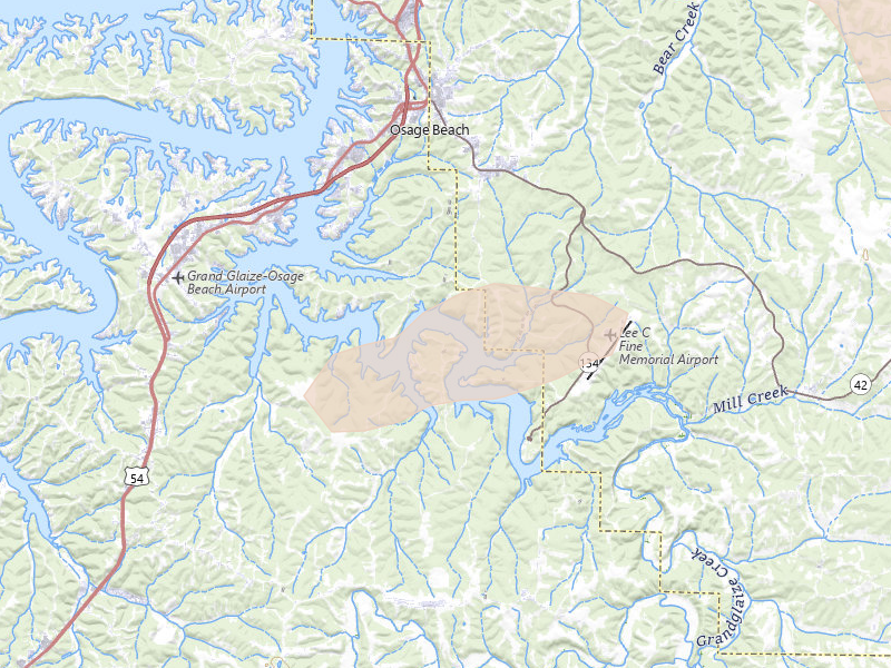 Estimated size field
 Radar-estimated hail size over the swath. The model reports the biggest stone the storm could sustain in the air; what actually fell may have been smaller.
The storm in context
Where Jul 10, 2026 sits in Linn Creek's hail record.
This was Linn Creek's 1st recorded hail day — the first hail day in our records for the city. By severity it ranks 1st of the 1 storms we have logged here. Radar put the day's largest stone over Linn Creek at 1" — the largest NEXRAD radar signature.
The Jul 10, 2026 convective day was bigger than Linn Creek: the same system put hail over 682 other tracked cities, 135 of them in Missouri. Nearest: Kaiser (7 miles north, up to 1.25"); Richland (9 miles southeast, up to 0.5"); Tuscumbia (11 miles northeast, up to 1.5").
These maps are stills. In the app this date is one of 1 Linn Creek storm date on a live map — both surfaces, the reports, and a replay — and the same map is where you draw the swath. This page rebuilds nightly.
Ground reports
What people on the ground reported
These are storm reports filed with the National Weather Service and released through the NOAA Storm Prediction Center — public-domain observations from spotters, the public, and NWS surveys. We quote each one exactly as filed.
For this storm over Linn Creek, the NWS report log is empty — a common outcome, since ground reports only happen when someone witnesses the hail and takes the time to call it in. The detection record for the date lives in the radar maps above.
Damage-capable hail signal
What 1" hail means for Linn Creek roofs.
Quarter-size and larger hail can bruise asphalt mats, remove granules, and dent exposed soft metal. The mapped footprint identifies an inspection priority area — it does not identify which individual roofs, if any, sustained damage.
Radar reading · not confirmed damage
Roofing exposure
What this storm is worth to a roofer.
Potential roof exposure
$2.3M
Potential roof exposure — 192 homes × the ~$12,000 industry-average hail roof claim. Exposure, not confirmed damage.
- Illustrative jobs
- 1 job
- Illustrative work
- ~$15K
Close just 0.5% of the 192 homes in this footprint at the average $15,000 roof job. Illustrative math, not a projection — your results depend on your outreach and how the market responds.
Claim window
July 2028
Claims from this storm can typically be filed until around July 2028 — the window to reach these homeowners while it's still open. Deadlines vary by policy and state.
Names and phones for every home in the footprint: at most $40 on top of the $150 plan.
Linn Creek hail history
Linn Creek's hail record.
The next storm won’t wait for you.
Set your territory and alerts today. When hail hits, use Overview to choose your streets and get moving.
7-day free trial in the iPhone app. No card required to start.
For iPhone. Android coming soon.
Web trial: 7 days free. Card required. $150/month after the trial unless cancelled.