
Open the newest Maine storm on the live map: radar as it comes in, NWS reports as they are filed, and both radar surfaces for any past storm date.
Roofing leads / Maine report
Maine roofing leads. Find your next area.
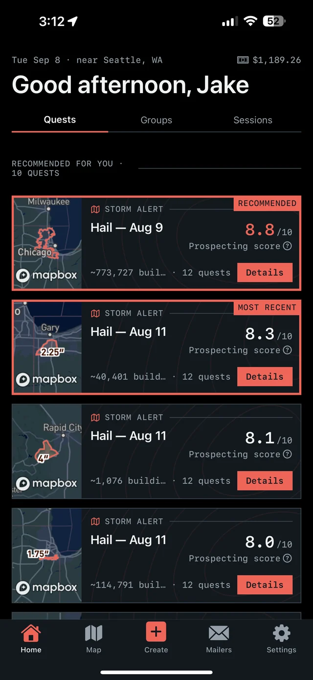
See where hail hit in Maine, then take the next step on iPhone. Overview brings together hail maps, recommended places to prospect, and tools for the doors you work.

7-day free trial in the iPhone app. No card required to start.
For iPhone. Android coming soon.

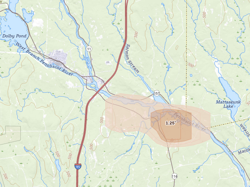
Radar-estimated size
Peak indicated size 1.25" Medway, ME
Overview for iPhone
Find your next move in Maine.
Hail maps, recommended places to prospect, and canvassing in one app.
01
See the hail
See storm footprints and radar-estimated hail size over the streets you could work.
02
Pick your area
Open your recommendations, compare the areas, and choose your next place to prospect.
03
Go canvass
Get directions, start your session, and keep a record of the doors you work.
Our proprietary Prospecting Score brings promising areas into focus. In the app, Quests turn recommendations, follow-ups, and unfinished work into a clear next move.
7-day free trial in the iPhone app. No card required to start.
For iPhone. Android coming soon.
Tracked markets 52 ME locality reports
Homes under the map 37,974 Across current locality footprints
Peak indicated size 1.75" ≈ golf ball
Storm record Jan 13 – Sep 6, 2026 Newest storm date 6 days ago
Maine markets
Move from the state report to the streets.
Each city record carries its storm history, peak indicated size, and the count of homes under the map.
Cumberland 1"
Portland
- Last storm date
- Aug 13, 2026
- Homes under the map
- 16,610
Cumberland 1"
Scarborough
- Last storm date
- Aug 13, 2026
- Homes under the map
- 14,296
Knox 1"
Union
- Last storm date
- Aug 13, 2026
- Homes under the map
- 1,806
Lincoln 0.5"
Bristol
- Last storm date
- Jun 28, 2026
- Homes under the map
- 654
Lincoln 0.5"
Alna
- Last storm date
- Jun 28, 2026
- Homes under the map
- 397
Somerset 1.25"
Moscow
- Last storm date
- Jul 22, 2026
- Homes under the map
- 379
York 0.75"
North Berwick
- Last storm date
- Jul 22, 2026
- Homes under the map
- 354
Aroostook 0.5"
Sinclair
- Last storm date
- Jun 17, 2026
- Homes under the map
- 313
Androscoggin 0.75"
Auburn
- Last storm date
- Jul 22, 2026
- Homes under the map
- 282
Androscoggin 0.75"
Minot
- Last storm date
- Jul 22, 2026
- Homes under the map
- 282
Piscataquis 0.75"
Rockwood
- Last storm date
- Aug 28, 2026
- Homes under the map
- 281
Kennebec 0.75"
Mount Vernon
- Last storm date
- Jun 28, 2026
- Homes under the map
- 267
Aroostook 0.75"
Blaine
- Last storm date
- Aug 20, 2026
- Homes under the map
- 242
Penobscot 1.75"
Medway
- Last storm date
- Sep 6, 2026
- Homes under the map
- 231
Sagadahoc 0.5"
Richmond
- Last storm date
- Apr 16, 2026
- Homes under the map
- 225
Piscataquis 0.75"
Abbot
- Last storm date
- Aug 28, 2026
- Homes under the map
- 203
Hancock 1"
Castine
- Last storm date
- Jun 28, 2026
- Homes under the map
- 139
Somerset 0.5"
Norridgewock
- Last storm date
- Aug 13, 2026
- Homes under the map
- 124
Waldo 0.5"
Brooks
- Last storm date
- Jun 21, 2026
- Homes under the map
- 75
Somerset 0.5"
Anson
- Last storm date
- Jun 12, 2026
- Homes under the map
- 65
Somerset 1"
Lexington Twp
- Last storm date
- Jul 22, 2026
- Homes under the map
- 58
Somerset 1"
New Portland
- Last storm date
- Jul 22, 2026
- Homes under the map
- 58
Aroostook 0.75"
Mattawamkeag
- Last storm date
- Sep 5, 2026
- Homes under the map
- 54
Penobscot 0.5"
Hampden
- Last storm date
- Jun 21, 2026
- Homes under the map
- 53
Lincoln 0.5"
Dresden
- Last storm date
- Apr 16, 2026
- Homes under the map
- 52
Somerset 0.75"
Harmony
- Last storm date
- Jun 28, 2026
- Homes under the map
- 51
Piscataquis 0.75"
Guilford
- Last storm date
- Aug 13, 2026
- Homes under the map
- 44
Somerset 0.5"
Saint Albans
- Last storm date
- Aug 28, 2026
- Homes under the map
- 41
Waldo 0.5"
Thorndike
- Last storm date
- Jun 21, 2026
- Homes under the map
- 40
Penobscot 0.75"
Millinocket
- Last storm date
- Aug 4, 2026
- Homes under the map
- 36
Aroostook 0.75"
Oakfield
- Last storm date
- Apr 8, 2026
- Homes under the map
- 35
Androscoggin 0.5"
Turner
- Last storm date
- Apr 1, 2026
- Homes under the map
- 34
Penobscot 0.5"
Newport
- Last storm date
- Aug 13, 2026
- Homes under the map
- 30
Aroostook 0.75"
Bridgewater
- Last storm date
- May 26, 2026
- Homes under the map
- 28
Aroostook 0.5"
Monticello
- Last storm date
- Jun 12, 2026
- Homes under the map
- 28
Piscataquis 0.5"
Brownville
- Last storm date
- Jun 12, 2026
- Homes under the map
- 24
Cumberland 0.5"
Gorham
- Last storm date
- May 12, 2026
- Homes under the map
- 21
Franklin 0.5"
Farmington
- Last storm date
- Jun 12, 2026
- Homes under the map
- 13
Kennebec 0.5"
South China
- Last storm date
- Aug 13, 2026
- Homes under the map
- 10
Aroostook 0.5"
Houlton
- Last storm date
- Jul 16, 2026
- Homes under the map
- 9
Aroostook 0.5"
Ludlow
- Last storm date
- Jul 16, 2026
- Homes under the map
- 9
Hancock 0.5"
Surry
- Last storm date
- Jun 21, 2026
- Homes under the map
- 9
Hancock 1"
Aurora
- Last storm date
- Jul 1, 2026
- Homes under the map
- 6
Somerset 1.25"
Bingham
- Last storm date
- Aug 28, 2026
- Homes under the map
- 2
Penobscot 0.5"
Kingman
- Last storm date
- Jul 19, 2026
- Homes under the map
- 1
Oxford 0.5"
South Paris
- Last storm date
- Jul 9, 2026
- Homes under the map
- 1
Penobscot 0.75"
Springfield
- Last storm date
- Jul 19, 2026
- Homes under the map
- 1
Oxford 0.5"
West Paris
- Last storm date
- Jul 9, 2026
- Homes under the map
- 1
Lincoln 0"
Bremen
- Last storm date
- Apr 16, 2026
- Homes under the map
- 0
Aroostook 0.5"
Island Falls
- Last storm date
- Jan 30, 2026
- Homes under the map
- 0
Washington 0.5"
Jonesboro
- Last storm date
- Jun 28, 2026
- Homes under the map
- 0
Cumberland 0"
Steep Falls
- Last storm date
- Apr 16, 2026
- Homes under the map
- 0
Reading the radar · High damage potential
What 1.75" radar-indicated hail means for field priority.
Hail around an inch and a half is capable of cracking shingles, stripping granules, and denting gutters, vents, and siding. Risk is usually greatest near the strongest radar signal, but property-level damage still requires an on-site inspection.
State response workflow
Three steps from radar to a door.
The map in the app is live. These pages rebuild nightly.
Review recommended areas in the iPhone app, or draw the streets you want to work. Use the hail and neighborhood context to make your choice.
Get directions, start a canvassing session, and record your door outcomes, notes, and next steps. Return to no-answer doors and unfinished coverage later.
Overview Pro · iPhone + web
Take Maine into the field.
The hail map, your next recommended area, and the tools to work it. Start on your own; the same subscription also includes access for up to 4 team members.
- Hail maps, storm history, and live radar
- Recommended prospecting areas and Quests
- Canvassing, navigation, and visit tracking
- Door notes, photos, and follow-up history
- Territory alerts and personal progress
Monthly subscription · US App Store
$149.99/ month
Try the app for 7 days. Choose whether to subscribe when your trial ends.
7-day free trial in the iPhone app. No card required to start.
For iPhone. Android coming soon.
200 addresses during the trial; 5,000 new addresses per user each month on Pro. Homeowner contacts ($0.21 each) and postcards ($0.75 each) are optional additional purchases.
Paid subscriptions renew monthly. Manage or cancel your App Store subscription in your Apple Account settings.
See all pricing and trial details →Take your next area into the field.
See the hail, review your recommendations, and canvass with Overview on iPhone.
7-day free trial in the iPhone app. No card required to start.
For iPhone. Android coming soon.
Radar tells you where to look. Only an inspection confirms damage at an address. Hail data is aggregated from public storm reporting and radar products; estimates are approximate. Contact availability varies by address.