
Open the newest New Jersey storm on the live map: radar as it comes in, NWS reports as they are filed, and both radar surfaces for any past storm date.
Roofing leads / New Jersey report
New Jersey roofing leads. Find your next area.
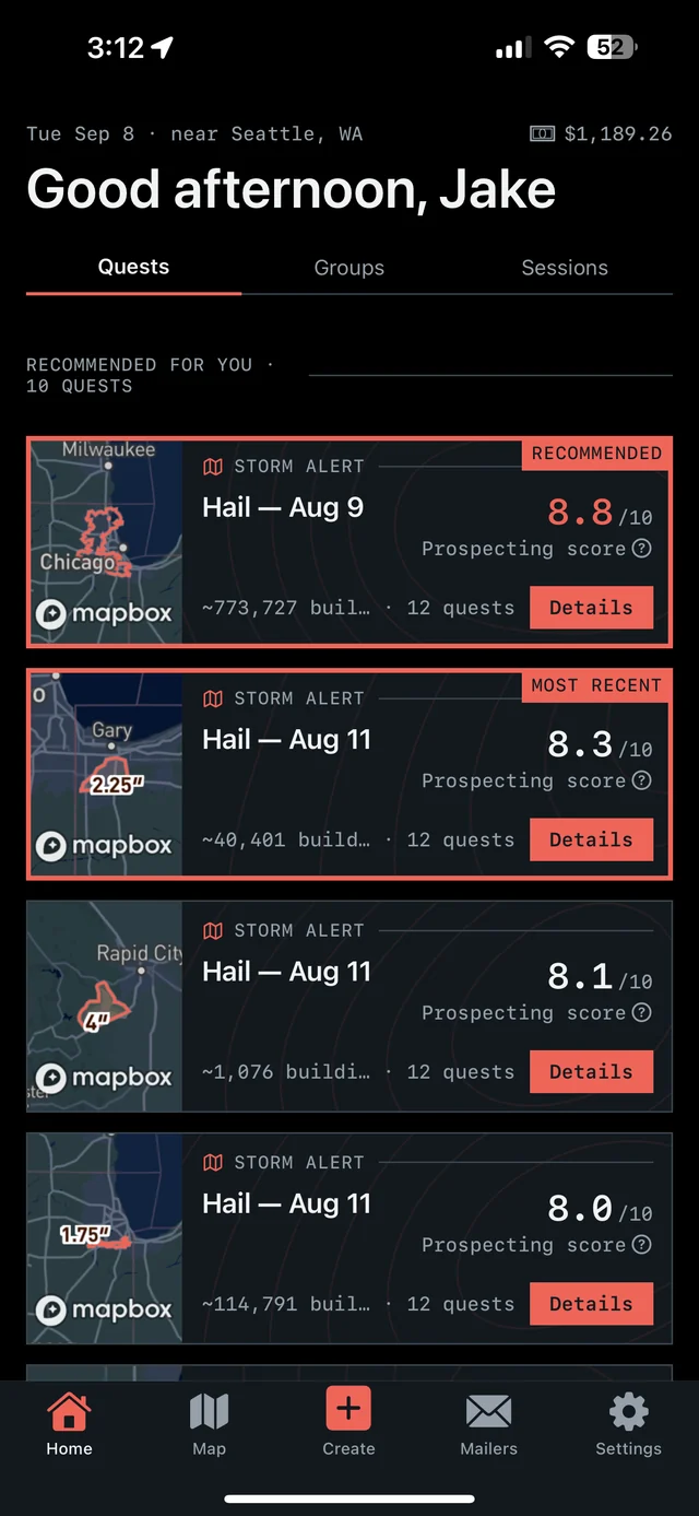
See where hail hit in New Jersey, then take the next step on iPhone. Overview brings together hail maps, recommended places to prospect, and tools for the doors you work.

7-day free trial in the iPhone app. No card required to start.
For iPhone. Android coming soon.

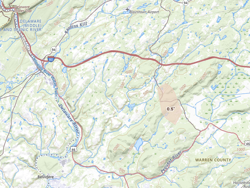
Radar-estimated size
Peak indicated size 0.5" Blairstown, NJ
Overview for iPhone
Find your next move in New Jersey.
Hail maps, recommended places to prospect, and canvassing in one app.
01
See the hail
See storm footprints and radar-estimated hail size over the streets you could work.
02
Pick your area
Open your recommendations, compare the areas, and choose your next place to prospect.
03
Go canvass
Get directions, start your session, and keep a record of the doors you work.
Our proprietary Prospecting Score brings promising areas into focus. In the app, Quests turn recommendations, follow-ups, and unfinished work into a clear next move.
7-day free trial in the iPhone app. No card required to start.
For iPhone. Android coming soon.
Tracked markets 139 NJ locality reports
Homes under the map 664,542 Across current locality footprints
Peak indicated size 2.5" ≈ baseball
Storm record May 20 – Sep 1, 2026 Newest storm date 11 days ago
New Jersey markets
Move from the state report to the streets.
Each city record carries its storm history, peak indicated size, and the count of homes under the map.
Bergen 2.25"
Fair Lawn
- Last storm date
- Jul 21, 2026
- Homes under the map
- 28,633
Bergen 2.25"
Saddle Brook
- Last storm date
- Jul 21, 2026
- Homes under the map
- 28,633
Ocean 1.25"
Tuckerton
- Last storm date
- Jul 16, 2026
- Homes under the map
- 23,565
Union 0.75"
New Providence
- Last storm date
- Sep 1, 2026
- Homes under the map
- 23,523
Ocean 1.25"
West Creek
- Last storm date
- Jul 16, 2026
- Homes under the map
- 23,477
Somerset 0.75"
Dunellen
- Last storm date
- Aug 7, 2026
- Homes under the map
- 22,679
Bergen 2.25"
Teaneck
- Last storm date
- Jul 27, 2026
- Homes under the map
- 20,692
Bergen 2.25"
River Vale
- Last storm date
- Jul 27, 2026
- Homes under the map
- 20,407
Bergen 1.25"
Ho Ho Kus
- Last storm date
- Aug 7, 2026
- Homes under the map
- 18,825
Passaic 1.75"
Little Falls
- Last storm date
- Aug 7, 2026
- Homes under the map
- 17,234
Monmouth 0.75"
Holmdel
- Last storm date
- Aug 27, 2026
- Homes under the map
- 17,045
Essex 1.5"
Short Hills
- Last storm date
- Jul 28, 2026
- Homes under the map
- 16,427
Union 1.5"
Union
- Last storm date
- Jul 28, 2026
- Homes under the map
- 16,427
Bergen 0.75"
Franklin Lakes
- Last storm date
- Aug 7, 2026
- Homes under the map
- 16,424
Ocean 1.75"
Long Beach Township
- Last storm date
- Jul 16, 2026
- Homes under the map
- 15,983
Bergen 2.25"
Westwood
- Last storm date
- Aug 7, 2026
- Homes under the map
- 15,860
Essex 1.5"
Livingston
- Last storm date
- Jul 28, 2026
- Homes under the map
- 14,371
Hudson 0.5"
Jersey City
- Last storm date
- Sep 1, 2026
- Homes under the map
- 13,076
Mercer 0.5"
Trenton
- Last storm date
- Jul 18, 2026
- Homes under the map
- 12,560
Middlesex 0.5"
South Amboy
- Last storm date
- Sep 1, 2026
- Homes under the map
- 11,555
Morris 1.25"
East Hanover
- Last storm date
- Sep 1, 2026
- Homes under the map
- 11,520
Passaic 1.75"
Woodland Park
- Last storm date
- Jul 27, 2026
- Homes under the map
- 11,465
Ocean 1.25"
Waretown
- Last storm date
- Jul 16, 2026
- Homes under the map
- 10,872
Gloucester 0.75"
Williamstown
- Last storm date
- Jul 27, 2026
- Homes under the map
- 10,021
Burlington 1"
Burlington
- Last storm date
- Aug 7, 2026
- Homes under the map
- 9,952
Somerset 1"
Somerset
- Last storm date
- Aug 7, 2026
- Homes under the map
- 9,700
Middlesex 0.75"
Old Bridge
- Last storm date
- Sep 1, 2026
- Homes under the map
- 8,912
Burlington 1"
Mount Holly
- Last storm date
- Jul 16, 2026
- Homes under the map
- 8,417
Gloucester 1"
Swedesboro
- Last storm date
- Aug 27, 2026
- Homes under the map
- 7,728
Morris 1.25"
Whippany
- Last storm date
- Jul 21, 2026
- Homes under the map
- 7,418
Monmouth 0.75"
Englishtown
- Last storm date
- Sep 1, 2026
- Homes under the map
- 7,398
Monmouth 0.75"
Colts Neck
- Last storm date
- Aug 27, 2026
- Homes under the map
- 7,081
Salem 1"
Pennsville
- Last storm date
- Aug 27, 2026
- Homes under the map
- 6,755
Burlington 1"
Moorestown
- Last storm date
- Jul 3, 2026
- Homes under the map
- 6,288
Salem 1"
Pedricktown
- Last storm date
- Aug 27, 2026
- Homes under the map
- 5,657
Middlesex 0.5"
South Plainfield
- Last storm date
- Jul 27, 2026
- Homes under the map
- 5,596
Morris 1.25"
Netcong
- Last storm date
- Jul 3, 2026
- Homes under the map
- 5,084
Sussex 1.25"
Stanhope
- Last storm date
- Jul 3, 2026
- Homes under the map
- 5,084
Burlington 1.5"
Southampton
- Last storm date
- Jul 16, 2026
- Homes under the map
- 4,606
Warren 2.5"
Phillipsburg
- Last storm date
- Jul 3, 2026
- Homes under the map
- 4,603
Monmouth 0.5"
Atlantic Highlands
- Last storm date
- Aug 7, 2026
- Homes under the map
- 4,540
Sussex 1.5"
Lafayette
- Last storm date
- Jul 3, 2026
- Homes under the map
- 4,369
Essex 2"
Fairfield
- Last storm date
- Jul 21, 2026
- Homes under the map
- 4,235
Gloucester 0.75"
Bridgeport
- Last storm date
- Aug 27, 2026
- Homes under the map
- 4,120
Somerset 1"
Bridgewater
- Last storm date
- Jul 3, 2026
- Homes under the map
- 4,029
Middlesex 1"
Monmouth Junction
- Last storm date
- Jul 3, 2026
- Homes under the map
- 3,907
Gloucester 0.5"
Mullica Hill
- Last storm date
- Jun 22, 2026
- Homes under the map
- 3,644
Sussex 1.75"
Branchville
- Last storm date
- Jul 3, 2026
- Homes under the map
- 3,629
Ocean 1.25"
Brick
- Last storm date
- Jul 18, 2026
- Homes under the map
- 3,541
Sussex 2"
Newton
- Last storm date
- Jul 3, 2026
- Homes under the map
- 3,360
Ocean 1.75"
Manahawkin
- Last storm date
- Sep 1, 2026
- Homes under the map
- 3,322
Warren 1.75"
Asbury
- Last storm date
- Jul 28, 2026
- Homes under the map
- 3,281
Warren 1.75"
Washington
- Last storm date
- Jul 28, 2026
- Homes under the map
- 3,281
Morris 2"
Lake Hopatcong
- Last storm date
- Jul 15, 2026
- Homes under the map
- 3,212
Essex 0.5"
Newark
- Last storm date
- Aug 27, 2026
- Homes under the map
- 3,085
Bergen 1.25"
Lyndhurst
- Last storm date
- Jul 21, 2026
- Homes under the map
- 3,065
Morris 1.25"
Mendham
- Last storm date
- Jul 21, 2026
- Homes under the map
- 3,044
Middlesex 1.5"
Monroe Township
- Last storm date
- Jul 28, 2026
- Homes under the map
- 2,905
Ocean 1"
Toms River
- Last storm date
- Jul 18, 2026
- Homes under the map
- 2,843
Gloucester 0.5"
Mount Royal
- Last storm date
- Sep 1, 2026
- Homes under the map
- 2,813
Morris 1.75"
Wharton
- Last storm date
- Jul 21, 2026
- Homes under the map
- 2,806
Camden 0.75"
Sicklerville
- Last storm date
- Jul 27, 2026
- Homes under the map
- 2,736
Morris 1.75"
Rockaway
- Last storm date
- Sep 1, 2026
- Homes under the map
- 2,706
Mercer 1"
Pennington
- Last storm date
- Aug 27, 2026
- Homes under the map
- 2,703
Somerset 0.75"
Branchburg
- Last storm date
- Jul 3, 2026
- Homes under the map
- 2,535
Somerset 0.75"
Somerville
- Last storm date
- Jul 3, 2026
- Homes under the map
- 2,535
Sussex 1.5"
Franklin
- Last storm date
- Jul 15, 2026
- Homes under the map
- 2,436
Sussex 1.5"
Sparta
- Last storm date
- Jul 15, 2026
- Homes under the map
- 2,436
Burlington 1.5"
Browns Mills
- Last storm date
- Jul 21, 2026
- Homes under the map
- 2,413
Warren 0.75"
Oxford
- Last storm date
- Aug 7, 2026
- Homes under the map
- 2,203
Sussex 1.25"
Montague
- Last storm date
- Aug 7, 2026
- Homes under the map
- 2,108
Sussex 1.25"
Sandyston
- Last storm date
- Jul 3, 2026
- Homes under the map
- 2,001
Cape May 1"
Cape May
- Last storm date
- Jul 21, 2026
- Homes under the map
- 1,840
Warren 1.75"
Belvidere
- Last storm date
- Jul 3, 2026
- Homes under the map
- 1,736
Hunterdon 1.75"
Frenchtown
- Last storm date
- Aug 7, 2026
- Homes under the map
- 1,594
Sussex 2"
Andover
- Last storm date
- Jul 15, 2026
- Homes under the map
- 1,441
Monmouth 0.5"
Eatontown
- Last storm date
- Aug 27, 2026
- Homes under the map
- 1,436
Mercer 1"
Titusville
- Last storm date
- Jul 27, 2026
- Homes under the map
- 1,396
Ocean 1.75"
Surf City
- Last storm date
- Jul 16, 2026
- Homes under the map
- 1,263
Warren 1.75"
Hardwick
- Last storm date
- Jul 3, 2026
- Homes under the map
- 1,209
Gloucester 0.75"
Glassboro
- Last storm date
- Sep 1, 2026
- Homes under the map
- 1,142
Burlington 1.25"
Pemberton
- Last storm date
- Jul 21, 2026
- Homes under the map
- 1,118
Ocean 0.5"
Bayville
- Last storm date
- Jul 27, 2026
- Homes under the map
- 1,012
Ocean 0.5"
Beachwood
- Last storm date
- Jul 27, 2026
- Homes under the map
- 1,012
Hunterdon 2.5"
Milford
- Last storm date
- Jul 28, 2026
- Homes under the map
- 965
Hunterdon 1"
Pittstown
- Last storm date
- Jul 3, 2026
- Homes under the map
- 940
Morris 1.25"
Kinnelon
- Last storm date
- Jul 21, 2026
- Homes under the map
- 917
Monmouth 0.5"
Millstone Township
- Last storm date
- Aug 7, 2026
- Homes under the map
- 861
Warren 0.75"
Port Murray
- Last storm date
- Aug 7, 2026
- Homes under the map
- 852
Hunterdon 2.5"
Glen Gardner
- Last storm date
- Jul 28, 2026
- Homes under the map
- 794
Hunterdon 1"
Flemington
- Last storm date
- Jul 28, 2026
- Homes under the map
- 793
Burlington 1.5"
Vincentown
- Last storm date
- Sep 1, 2026
- Homes under the map
- 724
Gloucester 0.5"
Sewell
- Last storm date
- Jul 27, 2026
- Homes under the map
- 637
Morris 1.75"
Butler
- Last storm date
- Sep 1, 2026
- Homes under the map
- 618
Cumberland 0.5"
Bridgeton
- Last storm date
- Aug 27, 2026
- Homes under the map
- 575
Ocean 1.25"
Little Egg Harbor Twp
- Last storm date
- Jul 16, 2026
- Homes under the map
- 521
Burlington 1.5"
Tabernacle
- Last storm date
- Jul 16, 2026
- Homes under the map
- 488
Burlington 1.5"
Chatsworth
- Last storm date
- Jul 16, 2026
- Homes under the map
- 480
Cape May 1"
Ocean View
- Last storm date
- Jul 4, 2026
- Homes under the map
- 465
Cape May 1"
Cape May Court House
- Last storm date
- Jul 4, 2026
- Homes under the map
- 458
Cape May 1"
Woodbine
- Last storm date
- Jul 4, 2026
- Homes under the map
- 458
Morris 1.75"
Kenvil
- Last storm date
- Jul 21, 2026
- Homes under the map
- 443
Hunterdon 0.75"
Lambertville
- Last storm date
- Jul 28, 2026
- Homes under the map
- 434
Bergen 0.5"
Mahwah
- Last storm date
- Jun 12, 2026
- Homes under the map
- 431
Morris 0.75"
Newfoundland
- Last storm date
- Sep 1, 2026
- Homes under the map
- 383
Cape May 0.5"
Marmora
- Last storm date
- Jul 4, 2026
- Homes under the map
- 333
Atlantic 0.5"
Mays Landing
- Last storm date
- Jul 4, 2026
- Homes under the map
- 333
Ocean 1"
Lakewood
- Last storm date
- Jun 7, 2026
- Homes under the map
- 286
Hunterdon 2.5"
Annandale
- Last storm date
- Jul 28, 2026
- Homes under the map
- 256
Warren 1"
Columbia
- Last storm date
- Aug 7, 2026
- Homes under the map
- 250
Ocean 1.25"
Barnegat
- Last storm date
- Jul 16, 2026
- Homes under the map
- 225
Burlington 1"
Bordentown
- Last storm date
- Jul 3, 2026
- Homes under the map
- 214
Burlington 1"
Columbus
- Last storm date
- Jul 3, 2026
- Homes under the map
- 214
Morris 0.5"
Chester
- Last storm date
- Jun 11, 2026
- Homes under the map
- 211
Morris 1.25"
Morristown
- Last storm date
- Sep 1, 2026
- Homes under the map
- 204
Ocean 0.5"
Point Pleasant Beach
- Last storm date
- Jul 18, 2026
- Homes under the map
- 183
Warren 2.5"
Blairstown
- Last storm date
- Sep 1, 2026
- Homes under the map
- 174
Hunterdon 2.5"
Lebanon
- Last storm date
- Jul 28, 2026
- Homes under the map
- 155
Mercer 0.75"
Hopewell
- Last storm date
- Aug 27, 2026
- Homes under the map
- 130
Burlington 0.5"
Shamong
- Last storm date
- Jul 27, 2026
- Homes under the map
- 129
Passaic 0.5"
Ringwood
- Last storm date
- Jun 12, 2026
- Homes under the map
- 116
Burlington 1.5"
Joint Base Mdl
- Last storm date
- Jul 21, 2026
- Homes under the map
- 88
Sussex 1"
Sussex
- Last storm date
- Aug 11, 2026
- Homes under the map
- 71
Atlantic 0.5"
Hammonton
- Last storm date
- Aug 27, 2026
- Homes under the map
- 48
Burlington 0.5"
Egg Harbor City
- Last storm date
- Aug 28, 2026
- Homes under the map
- 18
Monmouth 0.5"
Allentown
- Last storm date
- May 20, 2026
- Homes under the map
- 17
Monmouth 0.5"
Freehold
- Last storm date
- Jun 22, 2026
- Homes under the map
- 14
Ocean 0.5"
New Egypt
- Last storm date
- Jul 18, 2026
- Homes under the map
- 14
Ocean 1"
Manchester
- Last storm date
- Jul 3, 2026
- Homes under the map
- 13
Ocean 1"
Manchester Township
- Last storm date
- Jul 3, 2026
- Homes under the map
- 13
Cumberland 0.5"
Greenwich
- Last storm date
- Jul 28, 2026
- Homes under the map
- 1
Cumberland 1"
Fortescue
- Last storm date
- Jul 4, 2026
- Homes under the map
- 0
Cumberland 1"
Heislerville
- Last storm date
- Jul 4, 2026
- Homes under the map
- 0
Somerset 1.5"
Hillsborough
- Last storm date
- Jul 3, 2026
- Homes under the map
- 0
Burlington 1"
Marlton
- Last storm date
- Jul 3, 2026
- Homes under the map
- 0
Burlington 1"
Medford
- Last storm date
- Jul 3, 2026
- Homes under the map
- 0
Burlington 1"
Mount Laurel
- Last storm date
- Jul 3, 2026
- Homes under the map
- 0
Cumberland 1"
Port Norris
- Last storm date
- Jul 4, 2026
- Homes under the map
- 0
Camden 0.5"
Waterford Works
- Last storm date
- Aug 27, 2026
- Homes under the map
- 0
Reading the radar · Severe hail signal
What 2.5" radar-indicated hail means for field priority.
Two-inch-plus hail is capable of puncturing shingles, breaking skylights or windows, and heavily denting soft materials. The strongest radar bands warrant prompt inspection, but neither the signal nor the footprint confirms damage at a specific address.
State response workflow
Three steps from radar to a door.
The map in the app is live. These pages rebuild nightly.
Review recommended areas in the iPhone app, or draw the streets you want to work. Use the hail and neighborhood context to make your choice.
Get directions, start a canvassing session, and record your door outcomes, notes, and next steps. Return to no-answer doors and unfinished coverage later.
Overview Pro · iPhone + web
Take New Jersey into the field.
The hail map, your next recommended area, and the tools to work it. Start on your own; the same subscription also includes access for up to 4 team members.
- Hail maps, storm history, and live radar
- Recommended prospecting areas and Quests
- Canvassing, navigation, and visit tracking
- Door notes, photos, and follow-up history
- Territory alerts and personal progress
Monthly subscription · US App Store
$149.99/ month
Try the app for 7 days. Choose whether to subscribe when your trial ends.
7-day free trial in the iPhone app. No card required to start.
For iPhone. Android coming soon.
200 addresses during the trial; 5,000 new addresses per user each month on Pro. Homeowner contacts ($0.21 each) and postcards ($0.75 each) are optional additional purchases.
Paid subscriptions renew monthly. Manage or cancel your App Store subscription in your Apple Account settings.
See all pricing and trial details →Take your next area into the field.
See the hail, review your recommendations, and canvass with Overview on iPhone.
7-day free trial in the iPhone app. No card required to start.
For iPhone. Android coming soon.
Radar tells you where to look. Only an inspection confirms damage at an address. Hail data is aggregated from public storm reporting and radar products; estimates are approximate. Contact availability varies by address.